
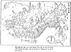
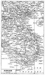
Bản đồ Đàng Trong với quần đảo Hoàng Sa và Trường Sa của VN

1820-1829 Siam And Cochin China John Crawfurd - Journal Of An Embassy
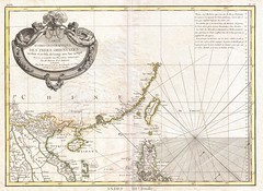
1771_Bonne_Map_of_Tonkin_(Vietnam)_China,_Formosa_ (Taiwan)_and_Luzon_(Philippines)_-_Geographicus_-_ Formosa
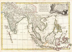
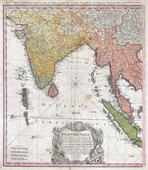
1770 - Bonne Map of India, Southeast Asia ^ The East Indies (Thailand, Borneo, Singapore) -
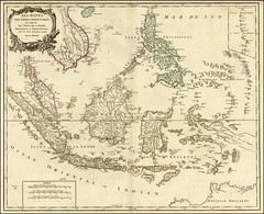
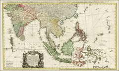
1750 (1785) - Archipel Des Indes Orientales, qui comprend Les Isles De La Sonde, Moluques et Philippines …
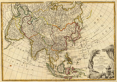
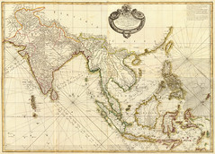
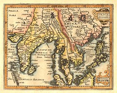
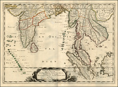
1748 - Homann Heirs Map of India and Southeast Asia
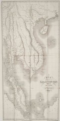
19th Unified Dai Nam Map
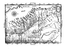
1651 - Carte de l'Annam par de Rhodes indiquant la 'Cocincina' (à gauche, i.e. au sud) et le 'Tvnkin' (à droite, i.e. au nord)
Bản đồ VN do giáo sĩ De Rhodes vẽ năm 1651 (BIG SIZE:3434 x 2462)
Uploaded on Jul 31, 2011
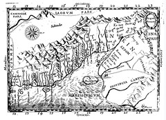
Old map of Vietnam by Alexandre de Rhodes (1591-1660)
Map of "Annam" drafted by Alexandre de Rhodes in 1651 showing "Cocincina" (left) and "Tunkin" (right).
Uploaded on Jan 10, 2010

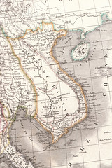
Royaume d’Annan Comprenant Les Royaumes de Tumkin et de la Cocinchine - Designé par les Pères de la Compagnie de Iesus. Paris 1650
Map of the region from Macao to Laos and Cambodia, centered on Vietnam, Annam and Tonkin region. One...
Uploaded on Dec 9, 2010
1609 - South and Southeast Asia from 'Atlas Minor' by Gerard Mercator and Jan Hondius (with later hand color)
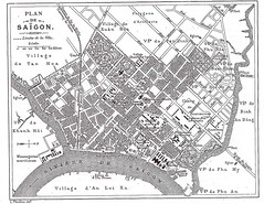
Plan de Saigon
Trên Bản đồ này chưa có Chợ Bến Thành và cầu quay Khánh Hội. Chợ BT xây từ 1911 và hoàn tất 1914, vậy có thể suy ra Bản đồ này là của SG trước 1914
Uploaded on Jul 31, 2011
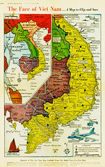
Vietnam War Map - The Dallas Morning News - Dec 12, 1965


Positions de Tourane - Bản đồ Đà Nẵng xưa tìm được trong nhà một ông quan ngày 15-9-1859
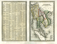
Bản đồ Đế quốc Miến Điện - với các xứ An Nam, Xiêm La và Nam Kỳ vẽ bởi Thomas Starling
Carte des Indes Orientales 1748 by Tobie Mayer - Bản đồ các nước Đông Ấn (ngày nay là Ấn Độ và các nước Đông Nam Á)
Nhận xét
Đăng nhận xét