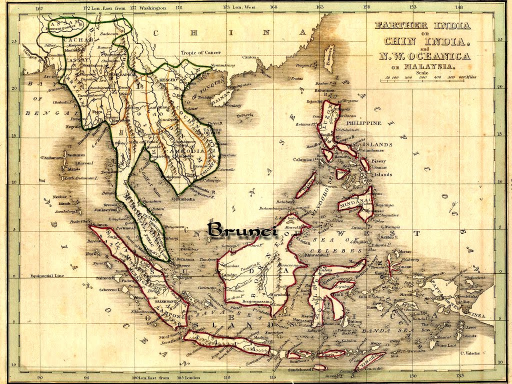
maps-southeast-asia-countries-old-antique

The time machine has stopped at 7th Century, back then there was no such thing as Malaysia yet, it was bunch of different kingdoms in South East Asia. It looks more like a Tolkien’s Fantasy world, in the north of we have the Angkor Kingdom (modern-day: Thailand & Cambodia)
speed_southeast_asia-a-new-map-of-east-india_1500
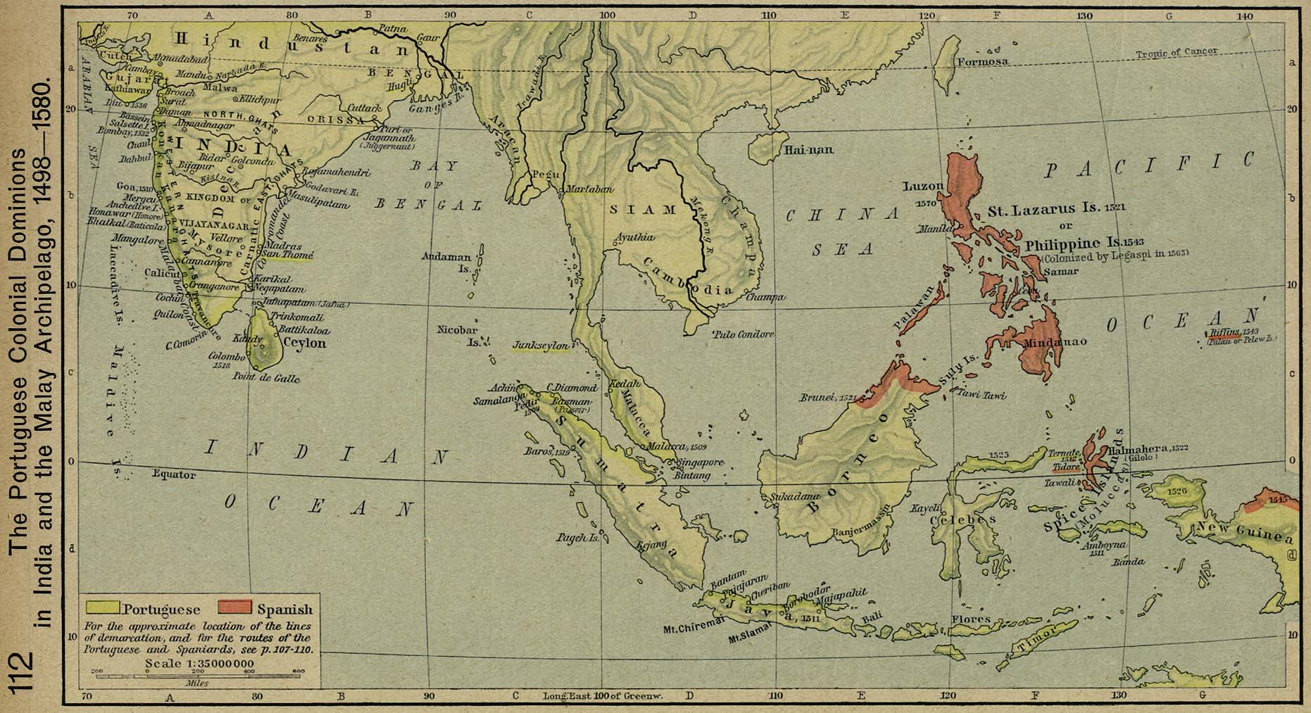
Portuguese Colonial Dominions 1498-1580, from Historical Atlas by William R. Shepherd — via

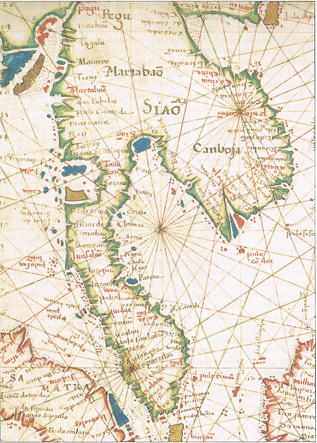
Depiction of Cambodia in a 17th-century Portuguese map
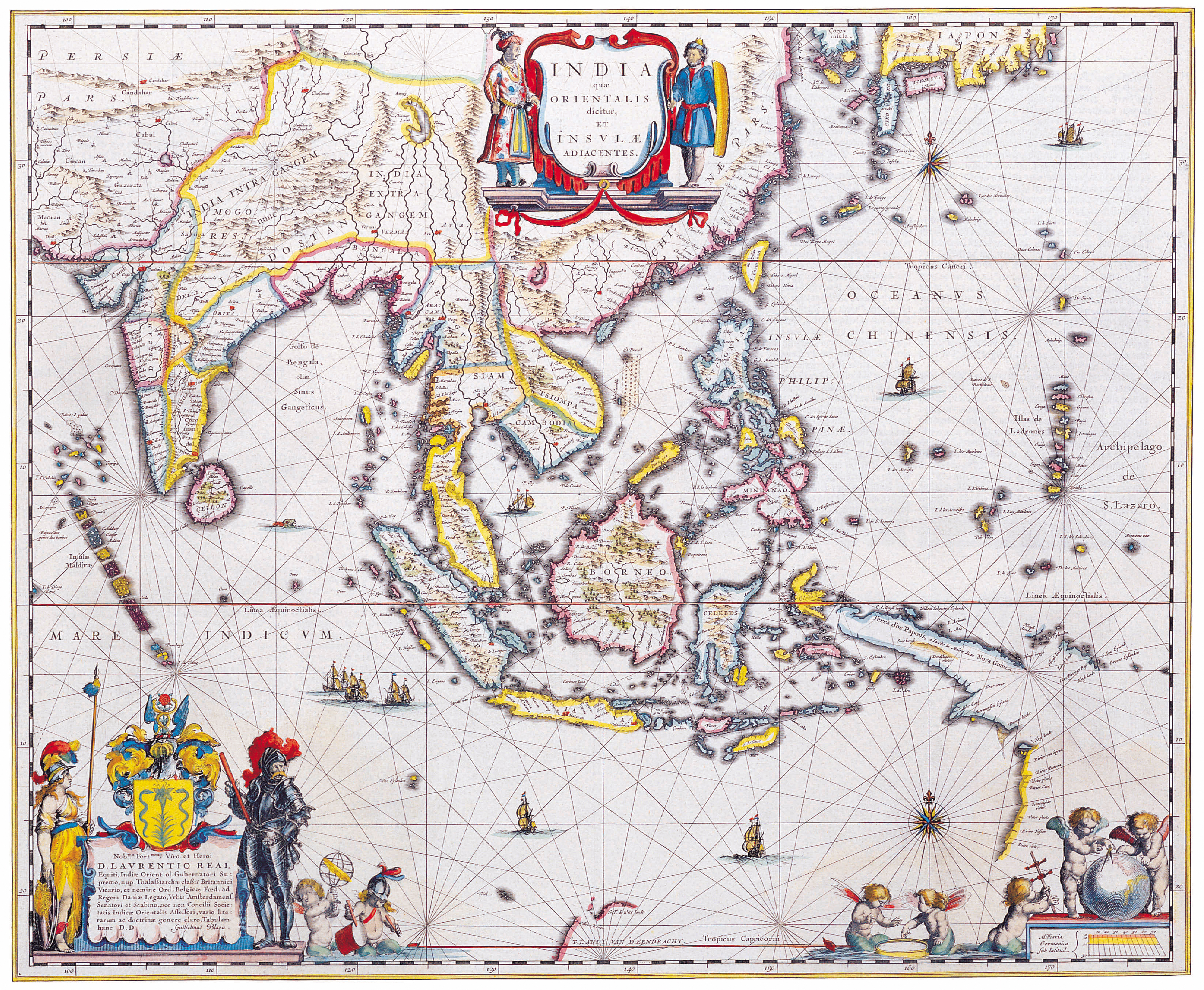
Mercator map of “India Orientalis”, Amsterdam 1619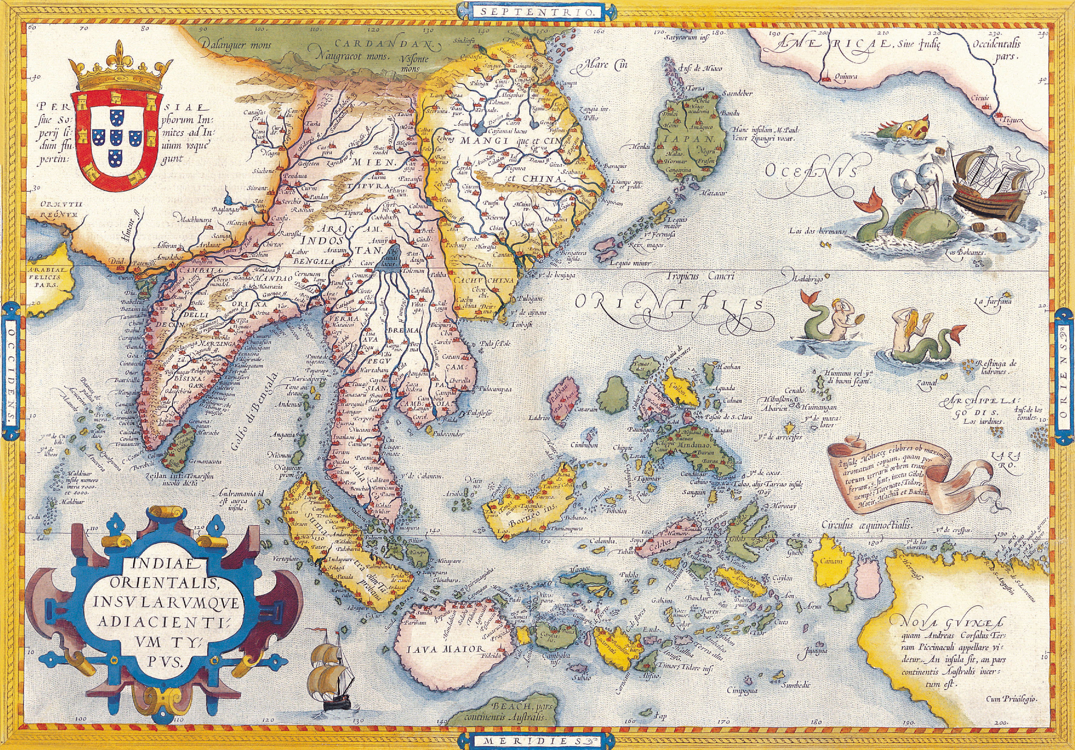
India Orientalis
Amsterdam, I.E. Cloppenburgh, 1632
Copper engraving, uncolored as published. A fine copy in a dark impression, full margins as published. This is the first so-called Cloppenburgh editions which was a competive edition with new engraved maps in a larger format. Most of the maps were engraved by Pieter van den Keere. The Cloppenburgh edition was continued for a couple of years but seems to have been suppressed after 1636 ... . This is another Cloppenburgh edition, now with Latin text. The maps from the Appendix have been incorporated. The title-page is followed by a dedication to Prince Frederik Hendrik, dated 1632 and signed by Johannes Cloppenburgh. (Koeman Atlantes Neerlandici). 19 x 26
In excellent condition. Koeman, ME 200
[Stock No.:20858]
1710 Ottens Map of Southeast Asia, Singapore, Thailand (Siam),
,_Malaysia,_Sumatra,_Borneo_-_Geographicus_-_Siam-ottens-1710.jpg)
The Principal Islands of the East-Indies. - Explaining what belongs to England, Spain and Holland &c. - By H. Moll Geographer.
London, Th. Bowles and John Bowles 1736
Copper engraving, decorative handcolored in outline. Small wide and decorative map showing the East Indies in Southeast Asia explaining what belongs to England, Spain and Holland. The map provides a good number of names of various larger and smaller islands and place names on those islands. The Geographer Hermann Moll worked came originally from the Netherlands and worked in London in the beginning for Moses Pitt. Later he became one of the important map publishers in England. The atlases, which he published were widely well known. He engraved as well maps for other English publishers (John Seller, etc.) . 197 by 270mm (7¾ by 10¾ inches).
In excellent condition.
[Stock No.:28019]

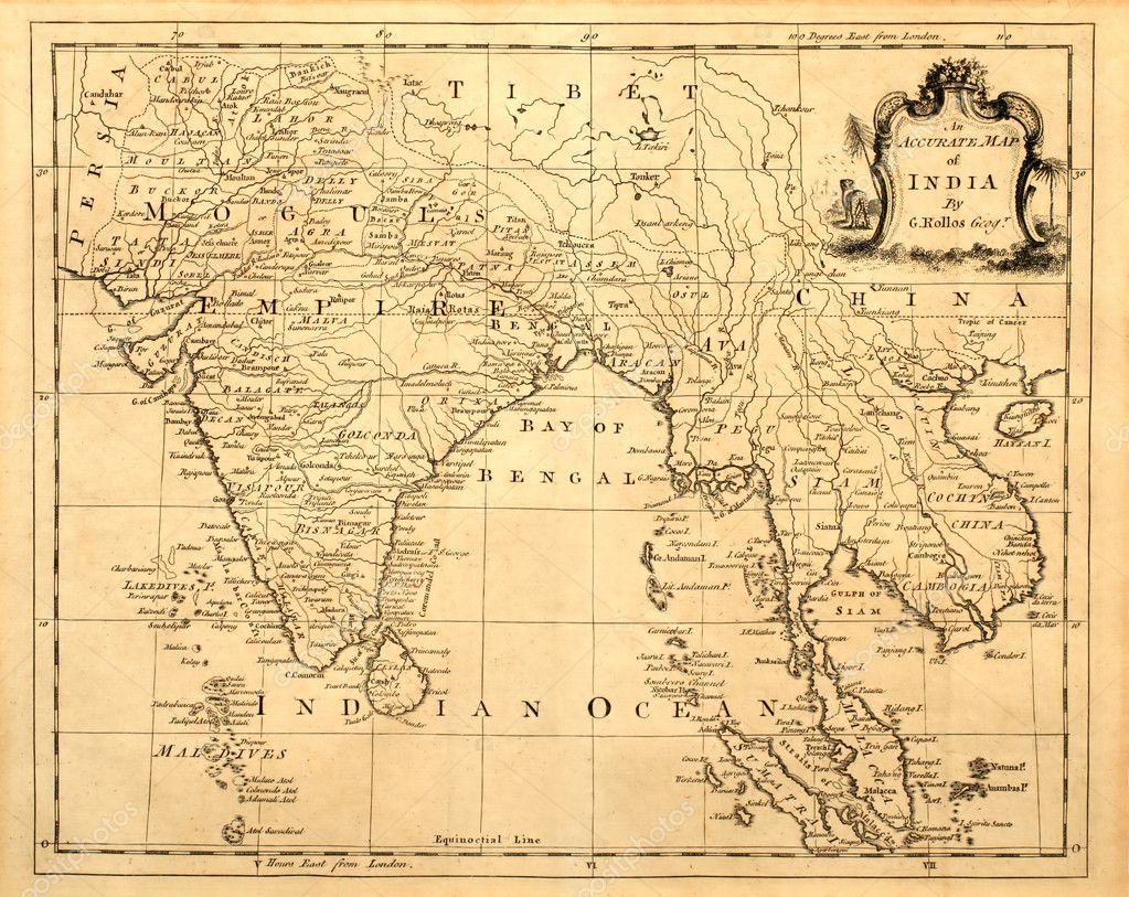
Antique map of India and Southeast Asia printed in 1750
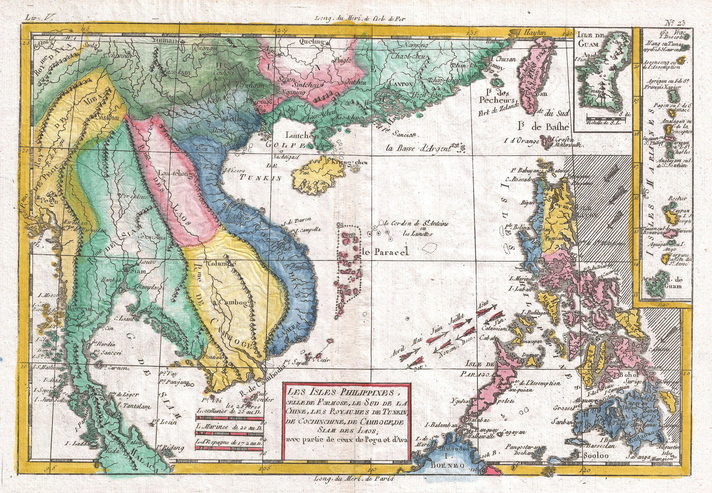
Cochinchine and Tunquin
Carte de Costes de Cochinchine Tunquin et Partie de celles de la Chine.
Paris, N. Bellin 1760
Copper engraving, hand colored in outline and wash. Detailed map of the region from the Cambodia River to Macao, along the coast of China. 207 by 142mm (8¼ by 5½ inches).
In excellent condition.
[Stock No.:28994]

Sumatra, Borneo, Malaca
Carte des Isles de Java, Sumatra Borneo & a les Détroits de la Sonde Malaca et Banca Golphe de Siam & Par N. Bellin Ingr. de la Marine.
Paris, N. Bellin 1760
Copper engraving, hand colored in outline and wash. 244 by 288mm (9½ by 11¼ inches).
In excellent condition.
[Stock No.:25768]

1770 Bonne Map of India, Southeast Asia
_-_Geographicus_-_SoutheastAsia-bonne-1770.jpg)
1780 Raynal and Bonne Map of Southeast Asia and the Philippines
An 1801 map of the East Indies.
_-_Geographicus_-_EastIndies-cary-1801.jpg)
East Indies
Charte von Ostindien Diesseits und Jenseits des Ganges nach den neuesten astronom. Beobachtungen auch andern sichern Huelfsmitteln neu entworfen und nach der lezten Zertheilung des Mysorischen Reichs berichtiget von I.C.M. Reinecke. Weimar im Verlage des Geograph. Instituts. revidirt im Aug. 1804.
Weimar, Geographisches Institut 1804
Copper engraving, hand colored in outline and wash when published. 47,1 x 86
In excellent condition.
[Stock No.:20936]

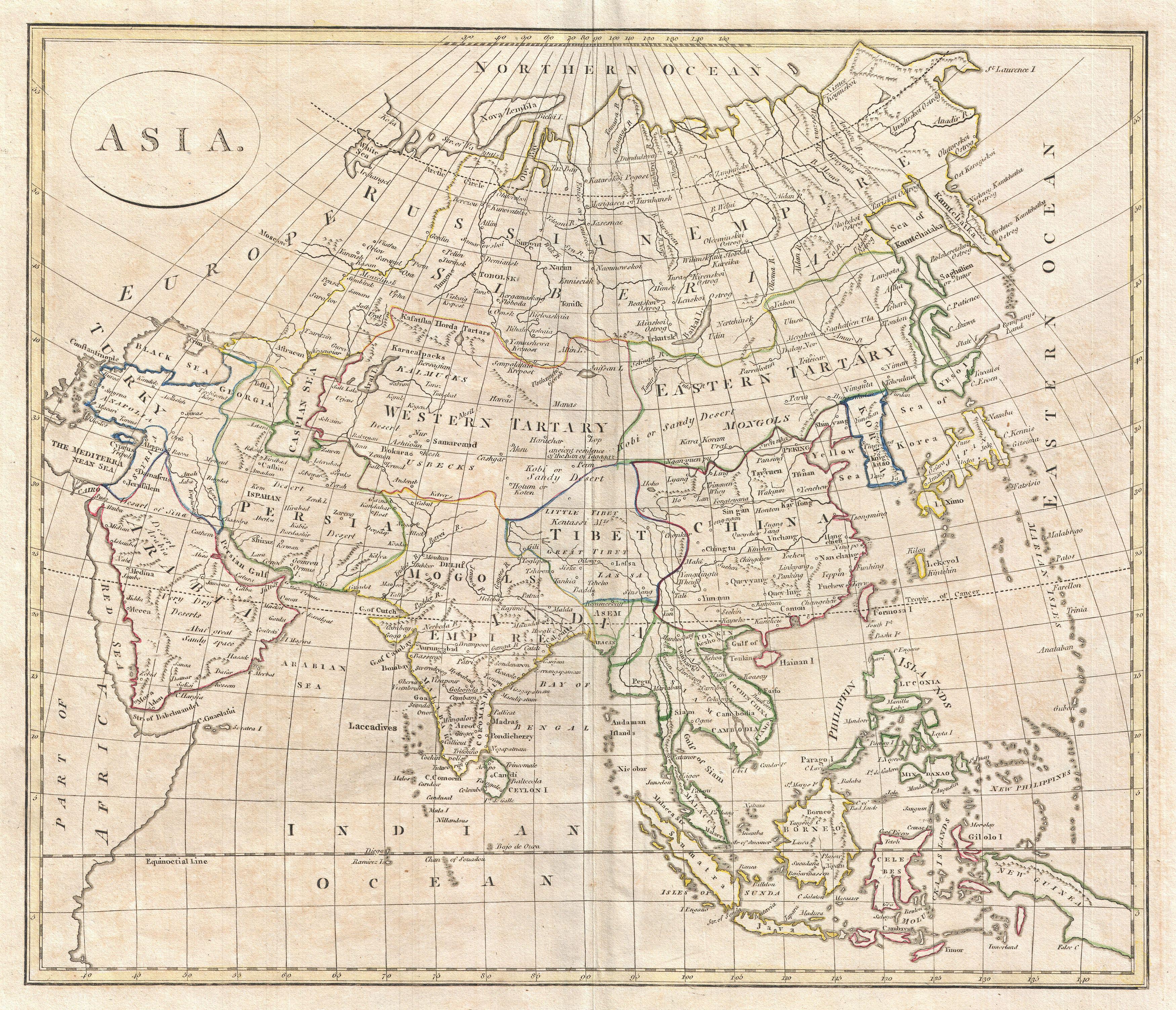
Asia 1808
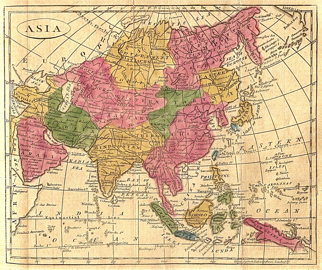
Southeast Asia
Océanique - Occidentale.
Paris, Giraldon 1812
Copper engraving, hand colored in outline. Engraved by Giraldon. A small decorative map of the region bounded by Taiwan, Pegu and Northern Australia, centered on the Philippines and Borneo. 220 by 300mm (8¾ by 11¾ inches).
In excellent condition.
[Stock No.:28024]


East India Islands
East India Islands.
Philadelphia, Carey & Lea 1832
Steel engraving, hand colored in outline and wash when published. Engraved by Dankworth, F. 88 by 140mm (3½ by 5½ inches).
In excellent condition.
[Stock No.:28258]

1852 Levasseur Map of India and Southeast Asia

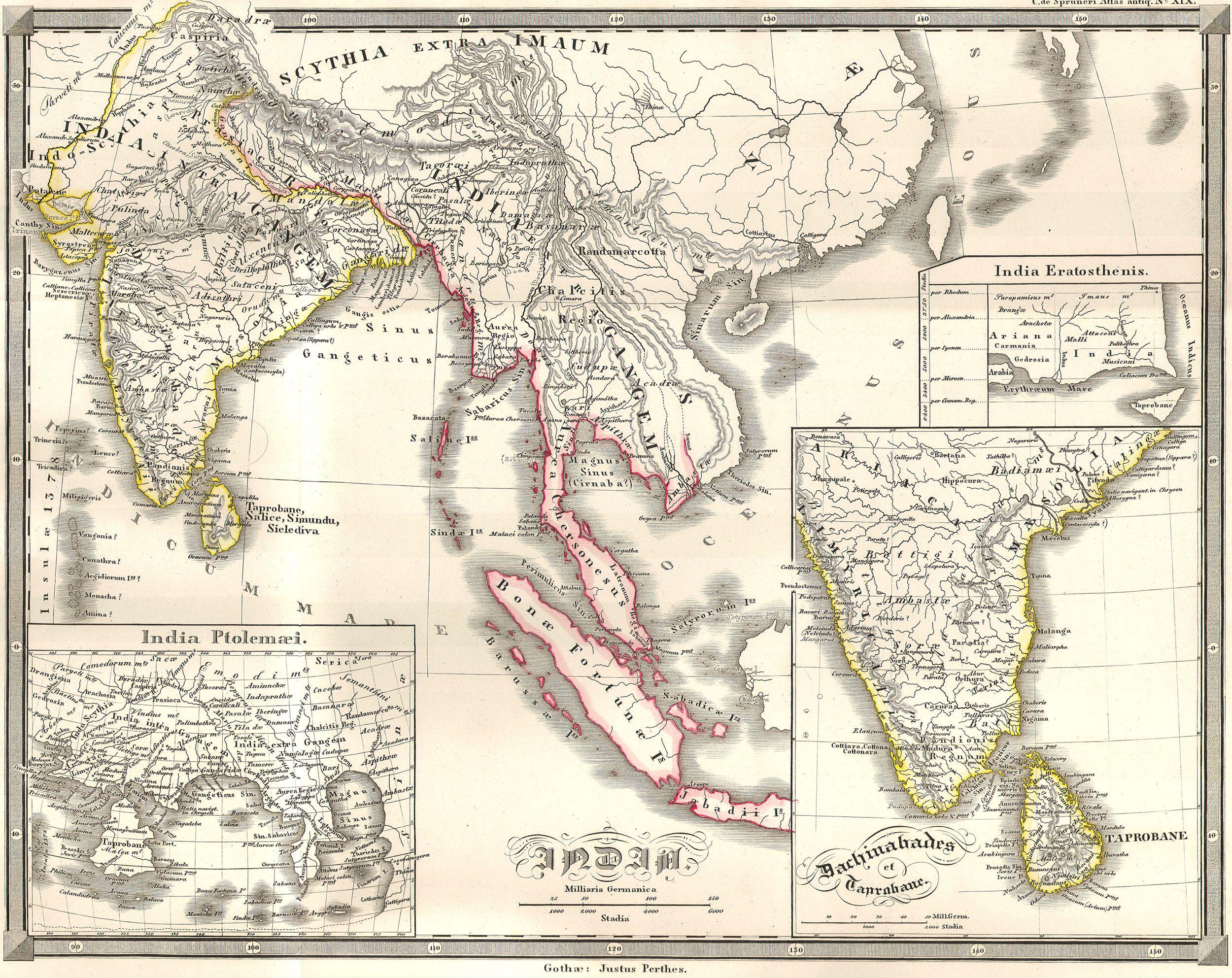
1855_Spruneri_Map_of_India_and_Southeast_Asia_in_Ancient_Times
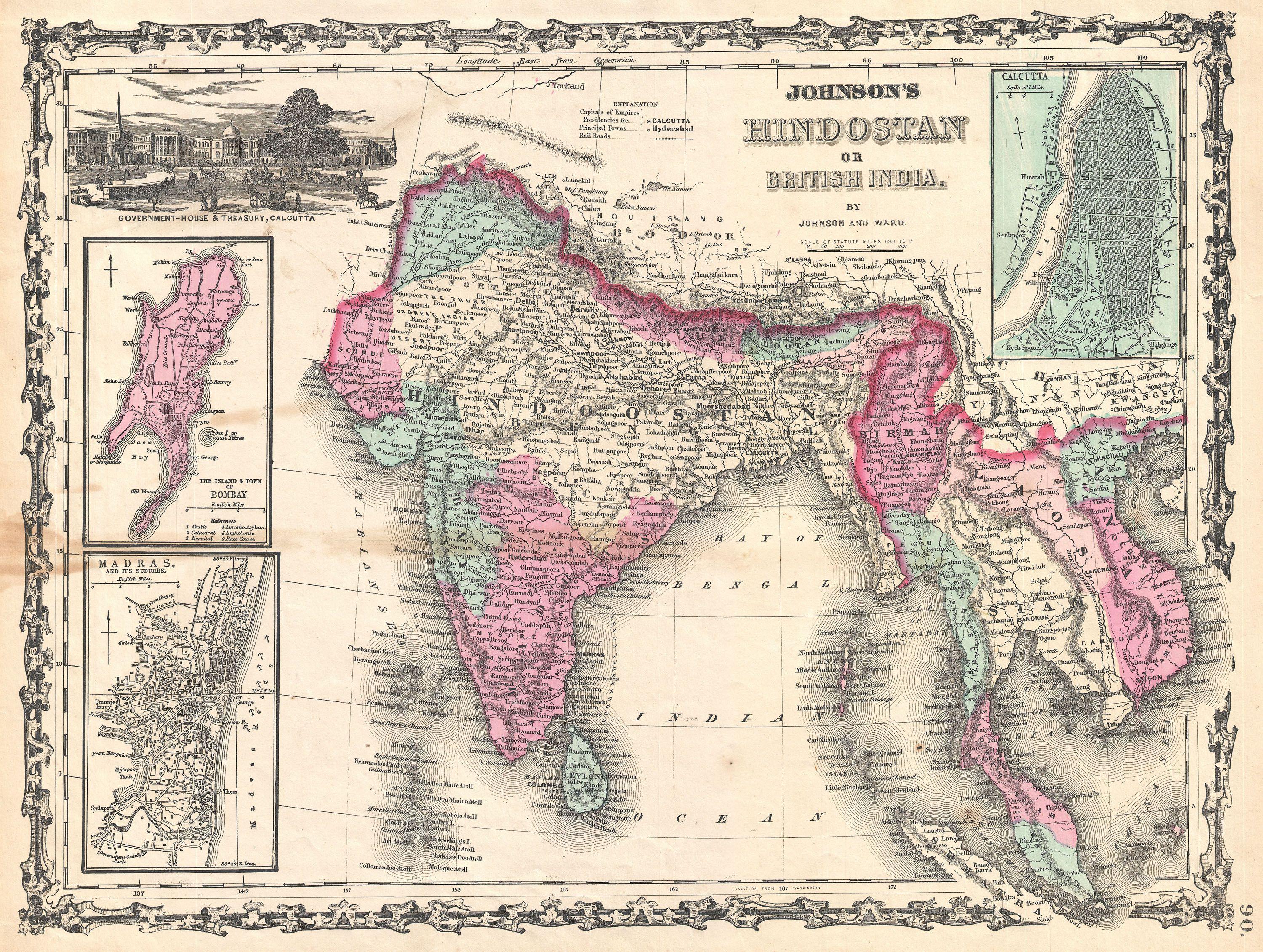
1862_Johnson_Map_of_India_and_Southeast_Asia
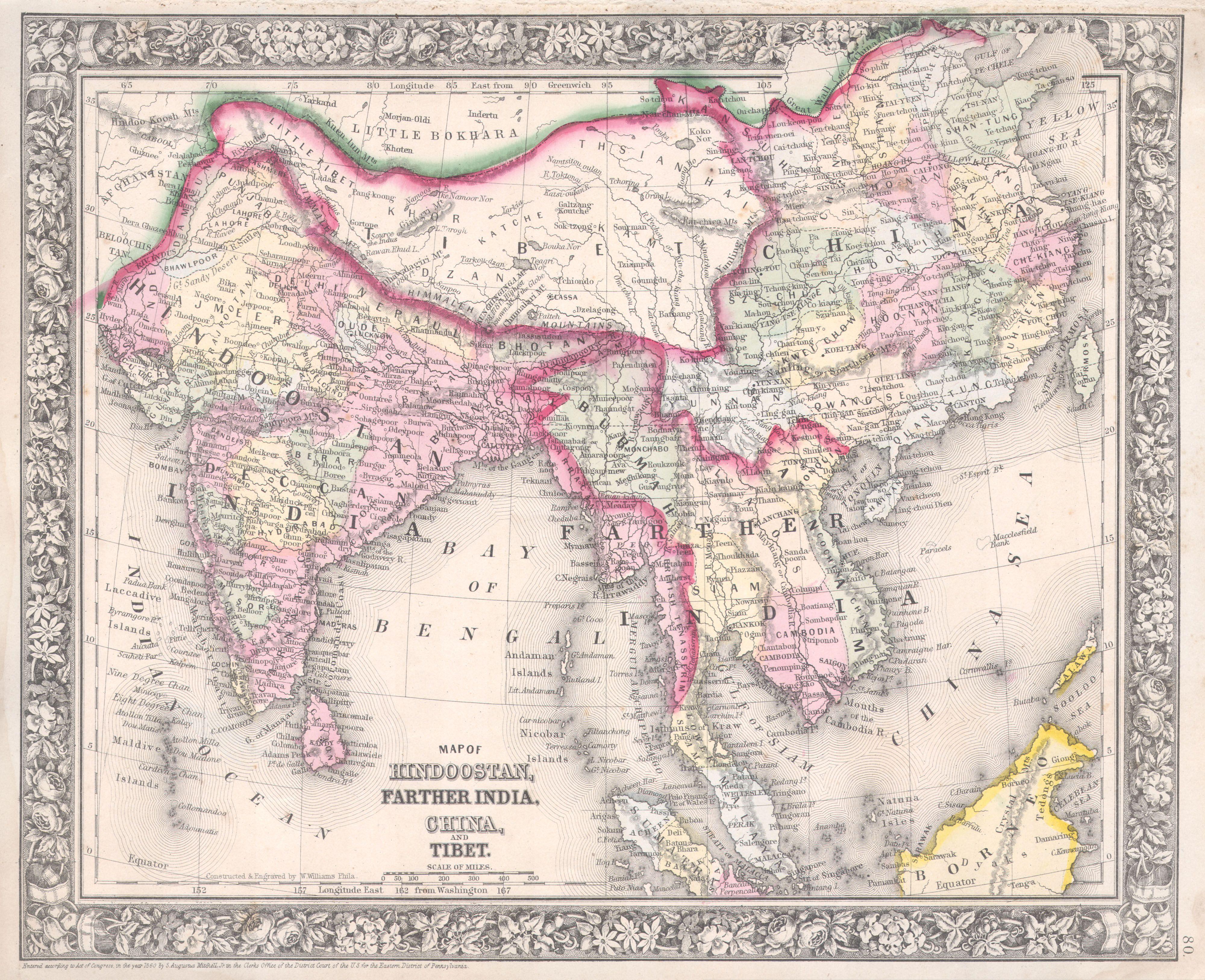
1864 Mitchell Map of India, Tibet, China and Southeast Asia

1865 Spruner Map of India and Southeast Asia

1870 Johnson Map of Australia, the East Indies, and Southeast Asi

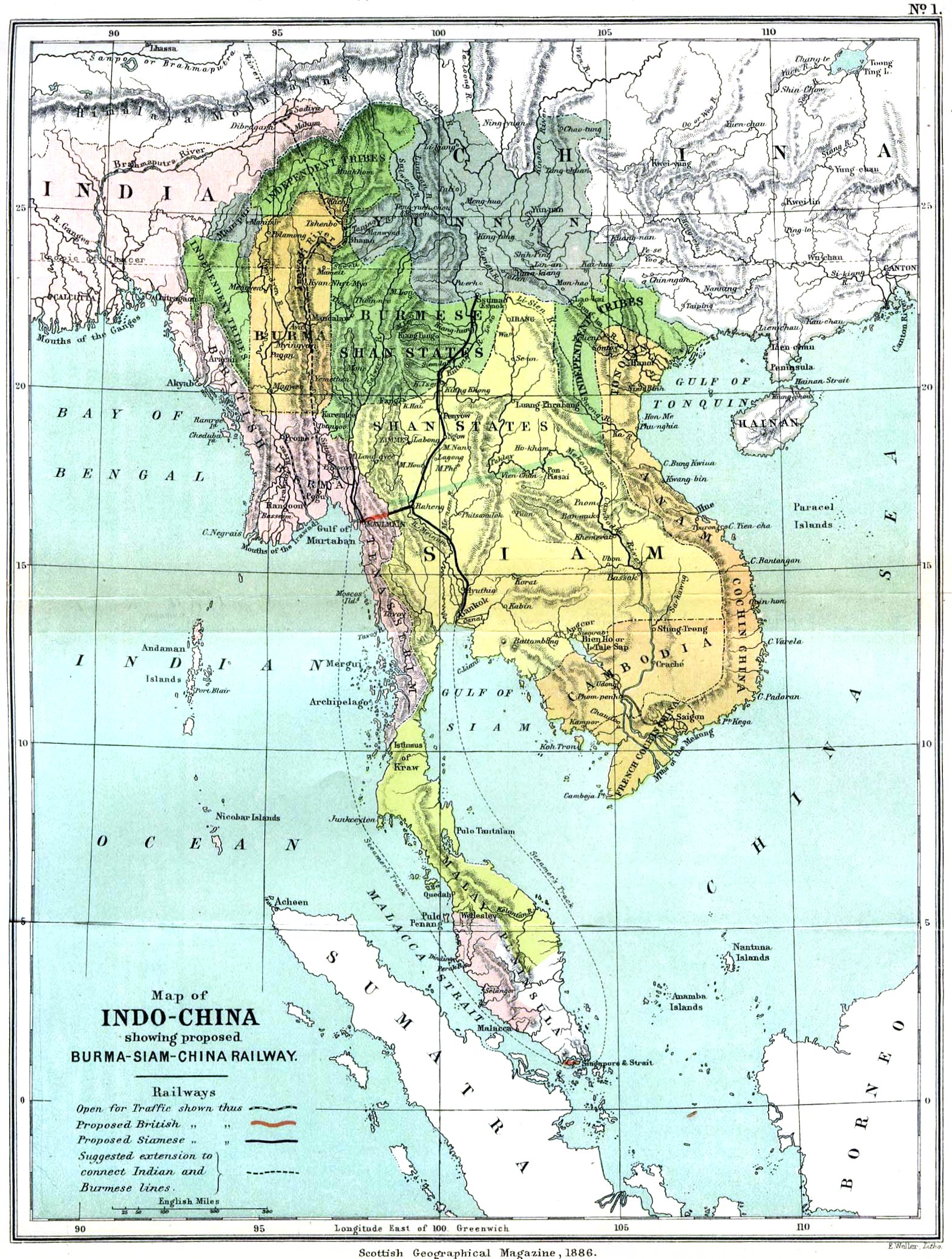
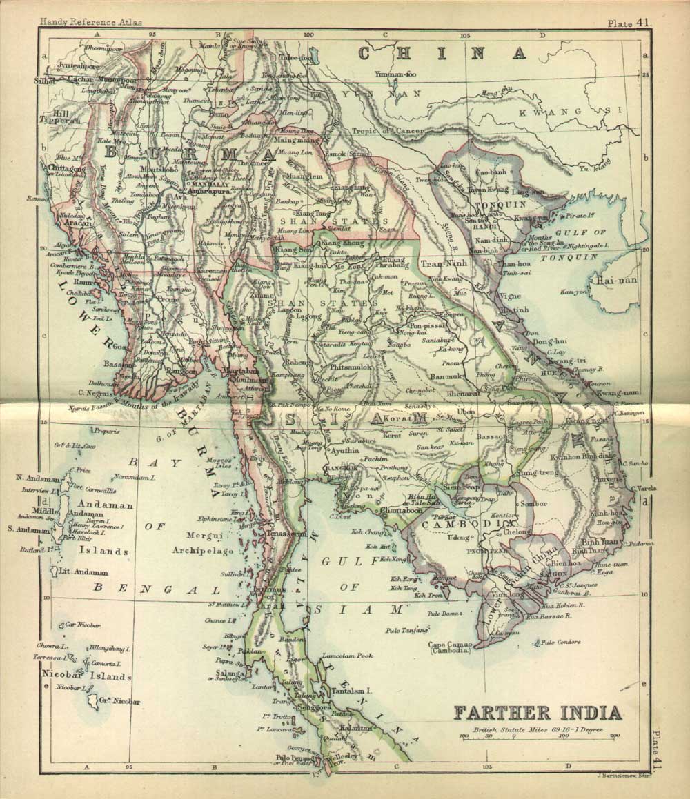
Mainland Southeast Asia, 1886
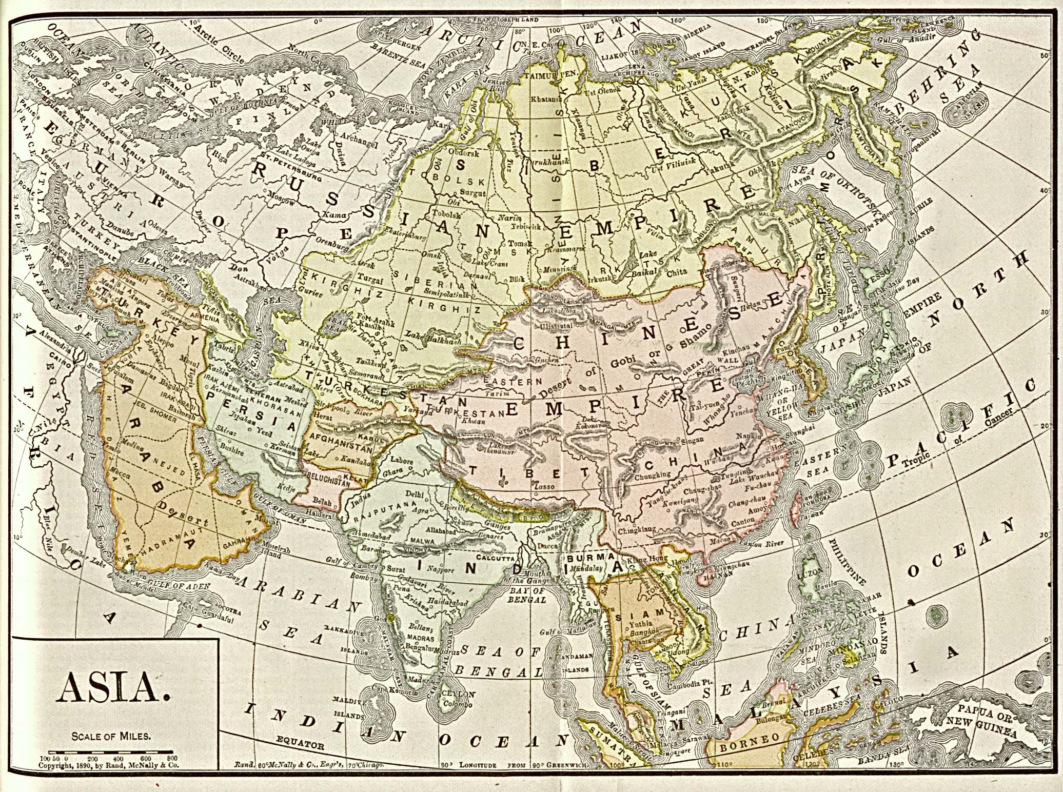
asia_1892_amer_ency_brit...
indochina-c1885
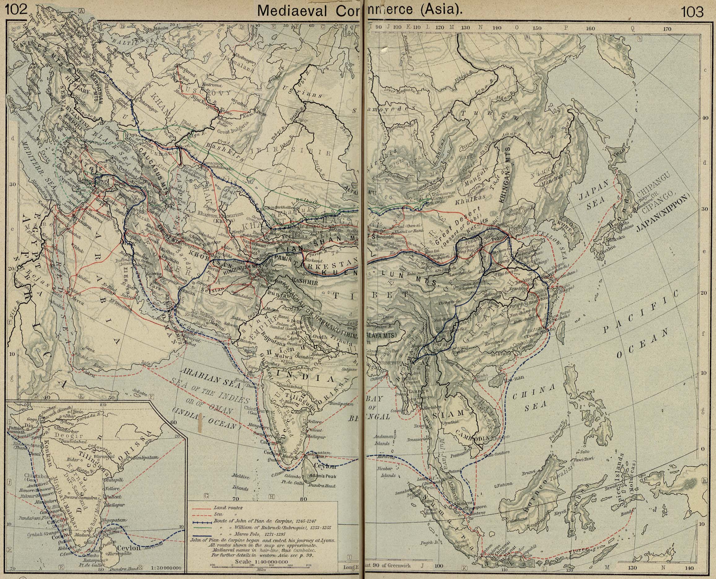
Mediaeval Commerce in Asia, from Historical Atlas by William R. Shepherd — via http://www.lib.utexas.edu/maps/historical/history_shepherd_1923.html
The time machine has stopped at 7th Century, back then there was no such thing as Malaysia yet, it was bunch of different kingdoms in South East Asia. It looks more like a Tolkien’s Fantasy world, in the north of we have the Angkor Kingdom (modern-day: Thailand & Cambodia)
speed_southeast_asia-a-new-map-of-east-india_1500
Portuguese Colonial Dominions 1498-1580, from Historical Atlas by William R. Shepherd — via
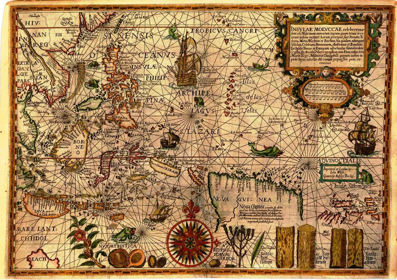
Insulae Moluccae Celeberrimae,” drawn by Petrus Plancius in 1598 and published in Linschoten’s “Itinerario,”considered the most important documents in the history of the mapping of Southeast Asia, was the top lot of an Old World Auctions sale that closed May 20 ($23,000, a record).
Antique Maps of the WorldMap of South East AsiaWillem Blaeuc 1650
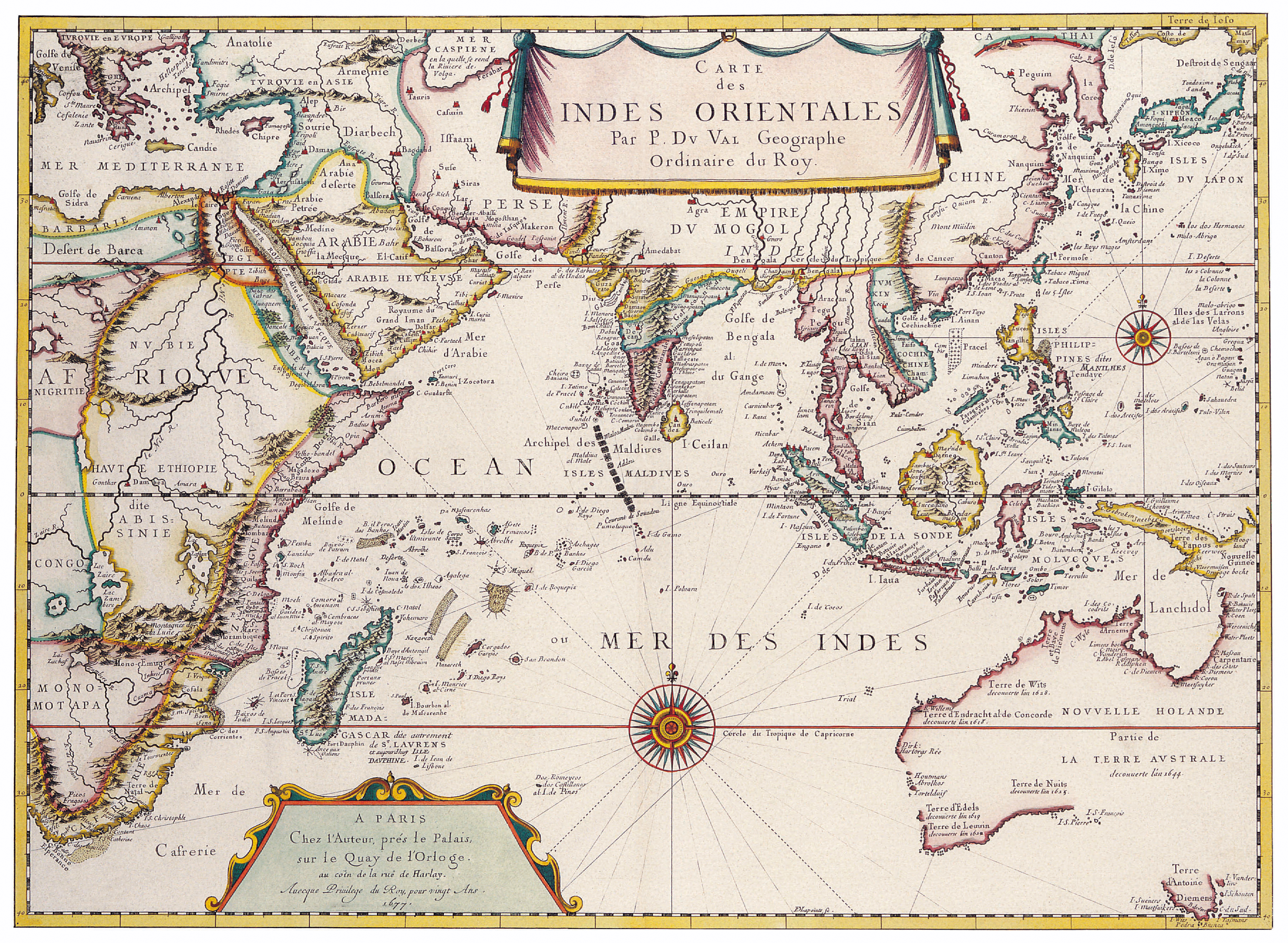
Antique Maps of the WorldMap of South East AsiaPierre Duvalc 1680
The Selden Map of China
This 17th century Chinese map, “rediscovered” in a collection in 2008 and much discussed by historians, shows Southeast Asia to a good degree of accuracy. It was probably copied from Japanese and Portuguese navigation maps of the time.
Depiction of Cambodia in a 17th-century Portuguese map
Mercator map of “India Orientalis”, Amsterdam 1619
India Orientalis
Amsterdam, I.E. Cloppenburgh, 1632
Copper engraving, uncolored as published. A fine copy in a dark impression, full margins as published. This is the first so-called Cloppenburgh editions which was a competive edition with new engraved maps in a larger format. Most of the maps were engraved by Pieter van den Keere. The Cloppenburgh edition was continued for a couple of years but seems to have been suppressed after 1636 ... . This is another Cloppenburgh edition, now with Latin text. The maps from the Appendix have been incorporated. The title-page is followed by a dedication to Prince Frederik Hendrik, dated 1632 and signed by Johannes Cloppenburgh. (Koeman Atlantes Neerlandici). 19 x 26
In excellent condition. Koeman, ME 200
[Stock No.:20858]
1710 Ottens Map of Southeast Asia, Singapore, Thailand (Siam),
The Principal Islands of the East-Indies. - Explaining what belongs to England, Spain and Holland &c. - By H. Moll Geographer.
London, Th. Bowles and John Bowles 1736
Copper engraving, decorative handcolored in outline. Small wide and decorative map showing the East Indies in Southeast Asia explaining what belongs to England, Spain and Holland. The map provides a good number of names of various larger and smaller islands and place names on those islands. The Geographer Hermann Moll worked came originally from the Netherlands and worked in London in the beginning for Moses Pitt. Later he became one of the important map publishers in England. The atlases, which he published were widely well known. He engraved as well maps for other English publishers (John Seller, etc.) . 197 by 270mm (7¾ by 10¾ inches).
In excellent condition.
[Stock No.:28019]
Antique map of India and Southeast Asia printed in 1750
Cochinchine and Tunquin
Bellin, Nicolaus
Carte de Costes de Cochinchine Tunquin et Partie de celles de la Chine.
Paris, N. Bellin 1760
Copper engraving, hand colored in outline and wash. Detailed map of the region from the Cambodia River to Macao, along the coast of China. 207 by 142mm (8¼ by 5½ inches).
In excellent condition.
[Stock No.:28994]
Sumatra, Borneo, Malaca
Bellin, Nicolaus
Carte des Isles de Java, Sumatra Borneo & a les Détroits de la Sonde Malaca et Banca Golphe de Siam & Par N. Bellin Ingr. de la Marine.
Paris, N. Bellin 1760
Copper engraving, hand colored in outline and wash. 244 by 288mm (9½ by 11¼ inches).
In excellent condition.
[Stock No.:25768]
1770 Bonne Map of India, Southeast Asia
1780 Raynal and Bonne Map of Southeast Asia and the Philippines
1783 Bonne Map of India, Southeast Asia, and East Indies
The map below includes extensive inland detail: it was drawn by Rigobert Bonne for Lattre’s Atlas Moderne.
1799 Clement Cruttwell Map of AsiaAn 1801 map of the East Indies.
East Indies
Reinecke, I.C.M.
Charte von Ostindien Diesseits und Jenseits des Ganges nach den neuesten astronom. Beobachtungen auch andern sichern Huelfsmitteln neu entworfen und nach der lezten Zertheilung des Mysorischen Reichs berichtiget von I.C.M. Reinecke. Weimar im Verlage des Geograph. Instituts. revidirt im Aug. 1804.
Weimar, Geographisches Institut 1804
Copper engraving, hand colored in outline and wash when published. 47,1 x 86
In excellent condition.
[Stock No.:20936]
Asia 1808
Southeast Asia
Malte-Brun, Conrad
Océanique - Occidentale.
Paris, Giraldon 1812
Copper engraving, hand colored in outline. Engraved by Giraldon. A small decorative map of the region bounded by Taiwan, Pegu and Northern Australia, centered on the Philippines and Borneo. 220 by 300mm (8¾ by 11¾ inches).
In excellent condition.
[Stock No.:28024]
Pinkerton’s 1818 map of the East Indies
This map is a copperplate engraving showing the “East India Isles” showing the south of Myanmar (Burma), Thailand, Cambodia, Vietnam, Laos, and Indonesia and the Philippines.
The map shows the island of Rakata (on the map “Rakama”) which was where Krakatoa erupted in 1883, changing that part of the map!
East India Islands
Dankworth, F.
East India Islands.
Philadelphia, Carey & Lea 1832
Steel engraving, hand colored in outline and wash when published. Engraved by Dankworth, F. 88 by 140mm (3½ by 5½ inches).
In excellent condition.
[Stock No.:28258]
1852 Levasseur Map of India and Southeast Asia
1855_Spruneri_Map_of_India_and_Southeast_Asia_in_Ancient_Times
1862_Johnson_Map_of_India_and_Southeast_Asia
1864 Mitchell Map of India, Tibet, China and Southeast Asia
1864 Johnson and Ward map of “Hindostan; or British India”
This map shows the extent of “The Raj” at its height.
1865 Spruner Map of India and Southeast Asia
1870 Johnson Map of Australia, the East Indies, and Southeast Asi
Mainland Southeast Asia, 1886
asia_1892_amer_ency_brit...
indochina-c1885
Mediaeval Commerce in Asia, from Historical Atlas by William R. Shepherd — via http://www.lib.utexas.edu/maps/historical/history_shepherd_1923.html
Cảm ơn thật nhiều!
Trả lờiXóa