http://www.panoramio.com/photo/18409535
Gò công :


European merchant ships in Hoi An in the 17th century.


Saigon1900
This photograph was taken around the turn of the Century on the Grande Place in Saigon and shows an execution with a Berger guillotine, probably one of the two machines photographed above. The two guillotines built in 1889 were ordered for "Le Tonkin" (Northern Vietnam) and "La Cochinchine" (Southern Vietnam and areas of Laos and Cambodia) but are now both exhibited in museums in Hanoi.
The photo was published as a postcard by Planté, a local Saigon editor.
The setting seems more casual than for executions in France. A few "priviledged" spectators, mostly military officers, have been allowed inside the line of troops keeping the crowd away. A close examination shows the ladder laying on the ground in front of the machine. It also appears that the cane basket is just being opened to receive the body while two assistants are pushing the condemned forward on the bascule.
Indies-Petrus-Plancius-1594-J.-Fisscher-1617-T.-Suarez-1999 Oldest British Map of the South China Sea
map-Birma-Siam-Thailand-Cambodia-Vietnam-by-P.-van-der-Aa-Leiden-1707
The Map of South and East Ocean Sea Routes was drawn in between 1712-1721 by Qing (Ching) Dynasty Fujian (Fuchien) Province Navy Commander Shi Shibiao, ...
*Southeast Asia, Indonesia, 1723*

vietnammaps1770
Jefferys, Thomas, -1771.
A new general map of the East Indies [cartographic material] : exhibiting in the Peninsula on this side of the Ganges, or Hindoostan the several partitions of the Mogul's Empire : and the Dominions of the English East India Company in the provinces of Bengal, Bahar, Orixa, as well as upon the coasts of Malabar and Coromandel ; with the French and Dutch possessions according to the peace of 1815 : and in the peninsula beyond the Ganges, the kingdoms of Assam, Cashar, Aua, Aracan, Mien, Pegu, Siam, Lao and Cambodia &cc.
1789. MAP RM 1423.
Pracel and Paracel
1771_Bonne_Map_of_Tonkin_(Vietnam)_China,_Formosa_(Taiwan)_and_Luzon_(Philippines)_-_Geographicus_-_Formosa-bonne-1771
Vietnam in 1829 under the Nguyễn Dynasty
1834 Vietnamese map showed the islands as Chinese "Wanli Changsha."
1834

1842 Greenleaf Map of the East Indies, Borneo, Java, Sumatra,

indochina-c1885


Quan cảnh - Sài Gòn - Panorama (Ngày Xửa Ngày Xưa - 1866 - Photo by Emile Gsell)


Đường Lê Lợi - 1960'


CH-54 Skycrane over Ducpho airfield (Photo by Robert Brackenhoff - 1970 / 1971)

UH-1 Hueys Takeoff in Ducpho airfield (Photo by Robert Brackenhoff - 1970 / 1971)
UH-1 Huey Sharks takeoff in "LZ Bronco" airfield (Photo by Robert Brackenhoff - 1970 / 1971)


Gò công :
European merchant ships in Hoi An in the 17th century.
Saigon1900
This photograph was taken around the turn of the Century on the Grande Place in Saigon and shows an execution with a Berger guillotine, probably one of the two machines photographed above. The two guillotines built in 1889 were ordered for "Le Tonkin" (Northern Vietnam) and "La Cochinchine" (Southern Vietnam and areas of Laos and Cambodia) but are now both exhibited in museums in Hanoi.
The photo was published as a postcard by Planté, a local Saigon editor.
The setting seems more casual than for executions in France. A few "priviledged" spectators, mostly military officers, have been allowed inside the line of troops keeping the crowd away. A close examination shows the ladder laying on the ground in front of the machine. It also appears that the cane basket is just being opened to receive the body while two assistants are pushing the condemned forward on the bascule.
Indies-Petrus-Plancius-1594-J.-Fisscher-1617-T.-Suarez-1999 Oldest British Map of the South China Sea
map-Birma-Siam-Thailand-Cambodia-Vietnam-by-P.-van-der-Aa-Leiden-1707
The Map of South and East Ocean Sea Routes was drawn in between 1712-1721 by Qing (Ching) Dynasty Fujian (Fuchien) Province Navy Commander Shi Shibiao, ...
*Southeast Asia, Indonesia, 1723*
vietnammaps1770
Jefferys, Thomas, -1771.
A new general map of the East Indies [cartographic material] : exhibiting in the Peninsula on this side of the Ganges, or Hindoostan the several partitions of the Mogul's Empire : and the Dominions of the English East India Company in the provinces of Bengal, Bahar, Orixa, as well as upon the coasts of Malabar and Coromandel ; with the French and Dutch possessions according to the peace of 1815 : and in the peninsula beyond the Ganges, the kingdoms of Assam, Cashar, Aua, Aracan, Mien, Pegu, Siam, Lao and Cambodia &cc.
1789. MAP RM 1423.
Pracel and Paracel
1771_Bonne_Map_of_Tonkin_(Vietnam)_China,_Formosa_(Taiwan)_and_Luzon_(Philippines)_-_Geographicus_-_Formosa-bonne-1771
Vietnam in 1829 under the Nguyễn Dynasty
1834 Vietnamese map showed the islands as Chinese "Wanli Changsha."
1834
1842 Greenleaf Map of the East Indies, Borneo, Java, Sumatra,
indochina-c1885
Đáp Cầu (Ngày Xửa Ngày Xưa - Photo by Dieulefils - 1900/10)
Chợ Vũng Tàu - Mache de Cap
Nhà thờ - Bắc Ninh - Church (Ngày Xửa Ngày Xưa - 1911)
Cửa nam thành Bắc Ninh
Bến - Nứa - Bus station
Cổng tam quan đền Ngọc Sơn
Hậu thất nhà thờ Lớn
Nhà máy xe lửa Gia Lâm
Nhà Tròn
Nhà thờ Lớn (Ngày Xửa Ngày Xưa - Beginning 20th Century - Photo by Dieulefils)
Ga Hải Phòng - Gare de Haiphong
Móng Cái
Hà Khẩu
Nhà hát Hải Phòng - Haiphong Theatre
Chợ - Hóc Môn - Marche
Cầu - Thành Thái - Pont
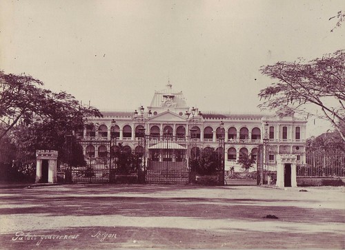
Bộ tổng tham mưu
Bảo tàng Lịch Sử
Cầu - Tournant - Bridge
Ghe cá Vũng Tàu
Chùa - Thiên Mụ - Pagoda
Toà Án
Tam quan chùa Thiên Mụ
Cầu sắt - Bến Lức - Steel bridge
Cầu sắt - Tân An - Steel bridge
Ga Biên Hoà - Gare de Bienhoa
C123K - Phanrang Airbase 1968/69 - Photo by Morris Hall
1965 Robert W Kelley -SG
Sông rạch vùng Chợ Lớn - Rạch Xóm Củi (?) (Ngày Xửa Ngày Xưa - 1866 - Photo by Emile Gsell)
Sài Gòn - 1866 - Photo by Emile Gsell
Rạch Tàu Hũ (Ngày Xửa Ngày Xưa - 1866 - Photo by Emile Gsell)
Cầu đầu đường Hải Thượng Lãn Ông (Ngày Xửa Ngày Xưa - 1866 - Photo by Emile Gsell)
Kinh Bến Nghé (Ngày Xửa Ngày Xưa - 1866 - Photo by Emile Gsell)
Sông Sài Gòn (Ngày Xửa Ngày Xưa - 1866 - Photo by Emile Gsell)
Cột cờ Thủ Ngữ (Ngày Xửa Ngày Xưa - 1866 - Photo by Emile Gsell)
Quan cảnh - Sài Gòn - Panorama (Ngày Xửa Ngày Xưa - 1866 - Photo by Emile Gsell)
Cầu - Tràng Tiền - Bridge (Ngày Xửa Ngày Xưa)
Thành - Sơn Tây - Fortress (Ngày Xửa Ngày Xưa)
Ga Nam Định (Ngày Xửa Ngày Xưa - 1912)
Cầu - Kho - Bridge (Ngày Xửa Ngày Xưa)
Chợ Sài Gòn (Ngày Xửa Ngày Xưa - 1908)
Đường - Paul Bert - Street (Ngày Xửa Ngày Xưa)
Dinh Norodom (Photo by Howard Sochurek - 1955)
Đường - Gallieni - Rue (Photo by Howard Sochurek - 1955)
Phủ Tổng Uỷ Di Cư Tị Nạn - 1955 (Photo by Howard Sochurek)
Sài Gòn - 1960'
Đường - Pasteur - Street (Ngày Xưa - 1960')
Đường Lê Lợi - 1980' - Khi còn bưu điện Quận 1
Đường Lê Lợi - 1960'
Sân bay - Phú Bài - Airport (Ngày Xưa - 1960')
Palace Hotel (Ngày Xưa - 1960')
Kim Thân Phật Tổ (Ngày Xưa - 1960')
Dinh Độc Lập(Ngày Xưa - 1960')
Chợ - Hàn - Market (Ngày Xưa - 1960')
Nhà thờ - Vĩnh Long - Catholic Church (Photo by Ron Alcott 1966/67)
Biehoa airport control tower (Ngày Xưa - 1960')
Thánh lễ (Ngày Xưa - 1960')
Đường Hai Bà Trưng (Ngày Xưa - 1960')
Quy Nhơn - 1960'
Hí viện - Trưng Vương - Cinema (Ngày Xưa - 1960')
Chợ Đồng Đăng - Lạng Sơn 1930'
Nhà hát - Hải Phòng - Theatre (Ngày Xửa Ngày Xưa - 1904)
Chợ - Bến Thành - Maket (1940)
R Mahoney - 1966/67 vĩnh long
Không ảnh ngã ba Vĩnh Long (Ngày Xưa - R Mahoney - 1966/67)
Không ảnh nhà thờ Lớn (Ngày Xửa Ngày Xưa)
Đền - Hùng Vương - Temple (Photo by Dennis - 1966)
Bến phà Thủ Thiêm (Photo by Dennis - 1966)
Thào Cầm Viên Sài Gòn (Photo by Dennis - 1966)
Trung tâm Sài Gòn (Photo by Dennis - 1966)
Trung tâm Sài Gòn (Photo by Dennis - 1966)
Trung tâm Sài Gòn (Photo by Dennis - 1966)
Hotel Majestic (Photo by Dennis - 1966)
Nhà thờ Đức Bà (Photo by Dennis - 1966)
Hạ viện (Photo by Dennis - 1966)
Toà Đô Chánh (Photo by Dennis - 1966)
Cầu Tràng Tiền bị sập - Mậu Thân - 1968
Cầu Tràng Tiền bị sập - Mậu Thân - 1968
Phố Tràng Tiền - July 01 1954
Khách sạn - Caravelle - Hotel (24-12-1966)
Đại sứ quán Mẽo (11-10-1967)
Phố chợ Bến Thành (19-01-1971)
Ga - Hàng Cỏ - Rail station (1940)
Toà án Q1 khi chưa bị phá bỏ để xây Sunwah (1989) - Photo by John R. Jones
Đg. Trần Hưng Đạo - Pleiku (photo by Bob Lynn's - 19/ January/1971)
Đường Trịnh Minh Thế - Pleiku 19 / January /1971 - Photo by Bob Lynn's
Không ảnh lò phản ứng hạt nhân Đà Lạt - Photo by Alfred Eisenstaedt - 1968
Bộ tư lệnh quân đội Nam Triều Tiên (1960')
Ngân hàng nhà nước - 22 March 1973 - Photo by Gary Bartlett
Sông - Tây Ninh - River (Ngày Xưa - Photo by John A. Hansen - 1965/1966)
Tây Ninh - 1965/1966 (Photo by John A. Hansen)
Bến xe - Tây Ninh - Bus station (Ngày Xưa - Photo by John A. Hansen - 1965/1966)
Đại sứ quán Anh - British Embassy (Ngày Xưa 1960')
Nghĩa Dũng Đài (Ngày Xưa 1968-69)
Bộ tư pháp VNCH (Ngày Xưa 1967-68)
Đường - Tự Do - Street (Ngày Xưa 1967-68)
Đường - Lê Thánh tôn - Street (Photo by Nordique - 1968)
Sài Gòn (Ngày Xưa 1970)
Xe điện Sài Gòn (Ngày Xưa - 1952)
Không ảnh trung tâm toà thánh Tây Ninh (Ngày Xưa 1960')
Mũi Nghinh Phong (Ngày Xưa 1967-68)
Quảng trường Mê Linh 1990'
Đường - Lê Lợi - Street (1966)
OV-10 Bronco landing in Ducpho airfield (Photo by Robert Brackenhoff - 1970 / 1971)
C-47 Skytrain landing (Photo by Robert Brackenhoff - 1970 / 1971)
C-130 Hercules takeoff (Photo by Robert Brackenhoff - 1970 / 1971)
C-123K Provider landing (Photo by Robert Brackenhoff - 1970 / 1971)
C-7 Caribou landing (Photo by Robert Brackenhoff - 1970 / 1971)
OV-1 Mohawk in Ducpho airfield (Photo by Robert Brackenhoff - 1970 / 1971)
H-53 Jolly Green and UH-1 Huey (Photo by Robert Brackenhoff - 1970 / 1971)
H-53 Jolly Green landing (Photo by Robert Brackenhoff - 1970 / 1971)
H-53 Jolly Greens (Photo by Robert Brackenhoff - 1970 / 1971)
CH-54 Skycrane over Ducpho airfield (Photo by Robert Brackenhoff - 1970 / 1971)
AH-1 Cobras in Ducpho airfield (Photo by Robert Brackenhoff - 1970 / 1971)
UH-1 Hueys Takeoff in Ducpho airfield (Photo by Robert Brackenhoff - 1970 / 1971)
UH-1 Huey Sharks takeoff in "LZ Bronco" airfield (Photo by Robert Brackenhoff - 1970 / 1971)
U-21A (Photo by Robert Brackenhoff - 1970 / 1971)
OV-10 Bronco in "LZ Bronco" airfield (Photo by Robert Brackenhoff - 1970 / 1971)
C-130 Hercules (Photo by Robert Brackenhoff - 1970 / 1971)
C-123K Provider takeoff (Photo by Robert Brackenhoff - 1970 / 1971)
O-1 Bird Dog and OV-1 Mohawk (Photo by Robert Brackenhoff - 1970 / 1971)
U-6 Beaver (Photo by Robert Brackenhoff - 1970 / 1971)
H-53 Jolly Green and UH-1 Hueys (Photo by Robert Brackenhoff - 1970 / 1971)
H-53 Jolly Greens in Ducpho airfield (Photo by Robert Brackenhoff - 1970 / 1971)
CH-47 Chinook in LZ Bronco airfield (Photo by Robert Brackenhoff - 1970 / 1971)
Hải đăng - Mũi Dinh (Cà Ná) - Light house (Ngày Xưa -1931)
Hải Vân Quan (Ngày Xửa Ngày Xưa -1919/1926)
Cầu - Cốc Lếu - Bridge (Ngày Xửa Ngày Xưa -1921/1935)
Bệnh viện - Lai Châu - Hospital (Ngày Xửa Ngày Xưa -1921/1935)
Sông - Đông Ba - River (Ngày Xưa -1948)
Bến - Đông Ba - Quai (Ngày Xưa -1948)
Chợ - Kỳ Lừa - Market (Ngày Xửa Ngày Xưa -1920')
Cầu - Trường Tiền - Bridge (Ngày Xửa Ngày Xưa -1919/1926)
Ga - Tháp Chàm - Rail station (Ngày Xưa -1947)
Toà thánh Tây Ninh - (Ngày xưa 18-09-1948)
Trung tâm Hà Nội - ( Không ảnh - Ngày xưa - 1931)
Tiểu chủng viện Á Thánh Phụng - Châu Đốc - (Ngày Xửa Ngày Xưa)
Đường - Võ Tánh - Street (Ngày Xưa 1960')
Mohawk revetments at Phu Hiep Army Airfield - 1970
Tuệ Thành Hội Quán (Ngày Xưa 1968)
Lockheed EC-121 takeoff - 1968
Cầu - Trà Khúc - Bridge (Ngày Xưa 1920-1935)
Cầu - Bồng Sơn - Bridge (Ngày Xưa 05-1947)
Cầu Nam Ô - 1926
Cầu vào Long Xuyên (Ngày Xưa 1920-1935 - Thông tin chưa chính xác - Cần giúp đỡ cải chính - Thank!)
Cầu vào Tam Đảo (Ngày Xưa 1919-1926)
Cầu - Kiều - Bridge (Ngay trước ngày 17-02-1979)
Ngân hàng Đông Dương - La Banque d'Indochine (Ngày Xưa 06-1928)
Km1231 Đường sắt xuyên Việt (Ngày Xưa 1920-1935)
Guồng nước sông Đà Rằng Phú Yên (Ngày xưa 1930')
Bệnh viện Chợ Rẫy - Chợ Lớn - Hôpital Lalong (Ngày Xửa Ngày Xưa 1931)
Nhà thờ Sài Gòn (Ngày xưa 1921-1935)
Sông Cà Mau và cầu Quay (Ngày xưa 1946)
Cửa - Ngọ Môn - Gate (Ngày xưa 1919-1926)
Nhà thờ Cha Tam (Ngày xưa 1919-1926)
Hàng quán dưới chân núi Bà Đen (Ngày xưa 1921-1935)
Đường xe điện Sài Gòn - Chợ Lớn (Ngày xưa 1919-1926)
A-1H Skyraider VNAF (Không Ảnh - Photo by Terry Love - September 1967)
Kinh thành Huế (Ngày Xưa - 1970 - Không Ảnh)
Vỉa hè đường Nguyễn Huệ (Photo by Tara Stevens - 1970)
Điện Thái Hoà (Ngày Xưa - 1967)
Ngọ Môn (Ngày Xưa - 1967)
Đà Lạt - Không Ảnh (Ngày Xưa 1970)
Đà Lạt - Không Ảnh (Ngày Xưa 1970)
Đà Lạt - Không Ảnh (Ngày Xưa 1970)
Free World HQ Saigon - 1969
Đại sứ quán Mỹ - US Embassy (14-07-1965)
Hải Vân Quan (Ngày Xưa 1970)
Nhà thờ - Dòng Chúa Cứu Thế - Church ( Photo by Carranza Collective - 1966)
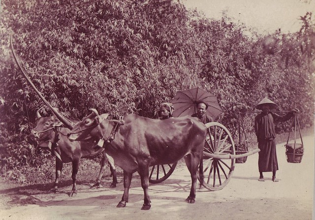
Người và bò kéo xe trên chở nước quốc lộ 1 Phan Thiết (March & April 1965 - Photo by John A. Hansen)
Bộ tổng tư lệnh QĐVNCH (Photo by lparkes - October 1964)
Pháp trường trung tâm Sài Gòn (Photo by lparkes - October 1964)
Bùng binh Hồ Con Rùa (Photo by lparkes - October 1964)
Nhà văn hoá Sài Gòn (Photo by lparkes - October 1964)
Saigon - July & August 1972 - © Photo by John A. Hansen
Cầu - Roòn - Bridge (1919-1926)
Nhận xét
Đăng nhận xét